Planning-Marketing Analysis: Projects 7, 8, and 9 in Gedera
Background And Momentum Of Development In Gedera
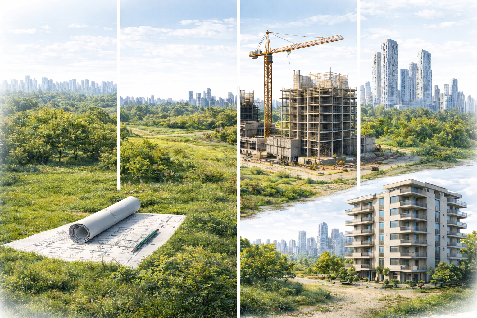
Gedera has been undergoing a development boom in recent years, following the approval of the comprehensive outline plan in 2019. In this article, we will analyze three major projects in Gedera – Complex 7 (an employment area in the south of the settlement), Complex 8 (a residential and employment district in the west of the settlement), and Complex 9 (the Nahal Sorek area set for environmental conservation) – from a planning and marketing perspective. We will review the general characteristics of each complex (location, land use, size, planning status), compare them using a table, and examine their attractiveness as land for investment. In addition, we will explain the process of thawing agricultural land in Israel, including key concepts such as yellow agricultural land and green agricultural land, accompanied by links to official sources. Finally, we will present practical insights for investors – which lands hold potential for profit and which are intended for conservation only.
Basic Concepts: Yellow Land and Green Land
Yellow Agricultural Land: A common term for agricultural land that is in the process of being rezoned (reconciled) to land for urban development. On planning maps, it is customary to mark such land in yellow, meaning land reserves designated for future construction. Yellow land is actually land that the district committee has already approved for urban zoning as part of a master plan and, as a result, a detailed plan for construction can be promoted for it. In practice, the land is still agricultural in nature, but it has a "planning horizon" to become part of the urban fabric in the near future.
Green Agricultural Land: Agricultural land that is intended to remain open and without any changes in regard for development. In the outline plans, these lands are defined as agricultural/green areas or landscape spaces, without the possibility of urban construction. Green land is excluded from entitlement tracks and has no future planning for housing or employment. Such land will be used for agriculture, parks or nature conservation and will not yield real estate improvement for investors (unlike yellow land that is on the way to construction).
Project 7: South Gedera Employment Complex (Complex 7)
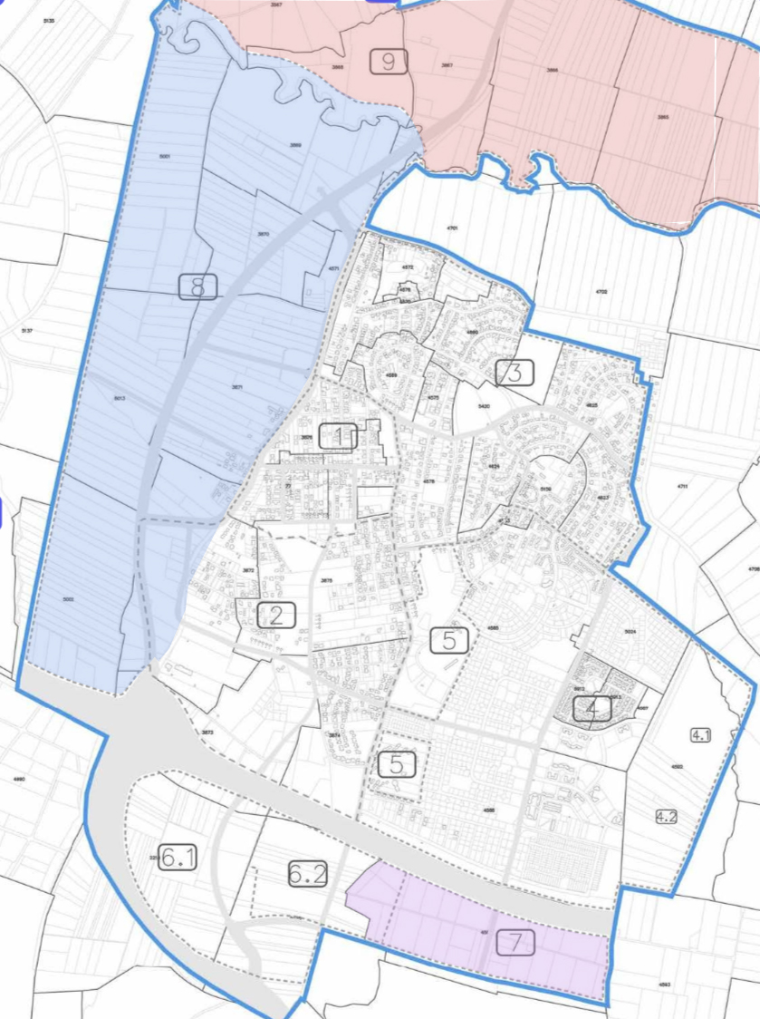
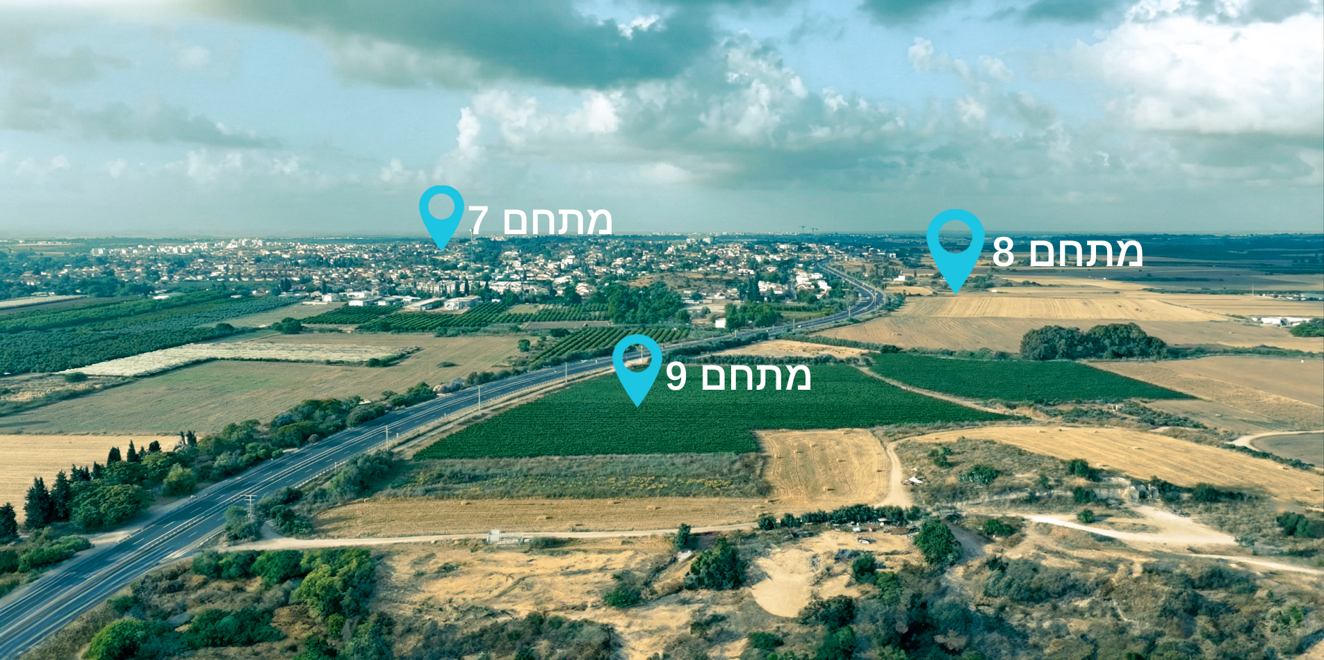
Location and general characteristics: Complex 7 is located in southern Gedera, east of Highway 40 (the southern extension of Herzl Street) and near a military base in the south of the settlement. The area of the complex is approximately 70 acres. In accordance with the plan's outline, the complex is defined as an employment and commercial complex combined with municipal facilities — for example, a land reserve for a new cemetery and a municipal stadium were planned within its boundaries. In other words, Project 7 is intended to serve as a southern employment park for Gedera, with a combination of industrial and commerce uses, as well as to satisfy the public needs of the settlement.
Planning Complexes | From the Outline of the Plan
Planning status: A detailed plan for the complex (Plan No. 460-0927541) was advanced by the "Apartment for Rent" company and the local council, and submitted to the planning institutions in 2022. In December 2022, the Central District Committee decided to deposit the plan with conditions, and approved in principle the proposed construction scope. As of today (2025), the plan is in the Deposit and Conditions Stage before final approval. After its approval and completion of the zoning change process (land thawing), the complex will officially transform from agricultural land to thawed land ready for development. According to estimates, the thawing and development of the land may occur within ~3 years from now.
Building rights: The plan's outline determined for Complex 7 building rights totaling approximately 1.6 million square feet for employment and office space, approximately 32,300 square feet for commerce and approximately 86,100 square feet for public buildings, in addition to allocating ~7 acres for a municipal stadium complex. During the planning of the detailed master plan, it was also proposed to increase the building rights: to approximately 2 million square feet for industry and logistics, 532,000 square feet for offices, 69,400 square feet for commerce, and 672,000 square feet for public buildings. This increase reflects an expectation of future demand and better utilization of the employment potential of the area.
Marketing characteristics: Complex 7 is yellow agricultural land (land in the process of being demarcated) with a future designation for employment – that is, land for investment that is planned to become a profitable area from a real estate perspective. The area is in an advanced planning stage and the certainty of its demarcation is relatively high (the plan is in the deposit, which leads to a high probability that the land will be demarcated soon). On the other hand, since the designation is for employment and commerce and not for residence, the profit potential from land improvement is more limited compared to land designated for residential construction. A certain advantage is the paucity of vacant employment areas in the Gedera area, but a disadvantage is the competition from nearby industrial areas in large cities (Rehovot, Yavne, etc.) which may affect demand for the area. Weighing these factors, real estate agents rank the profit potential of Complex 7 as medium (about 2 out of 5) while the certainty of demarcation and planning as high (about 4 out of 5).
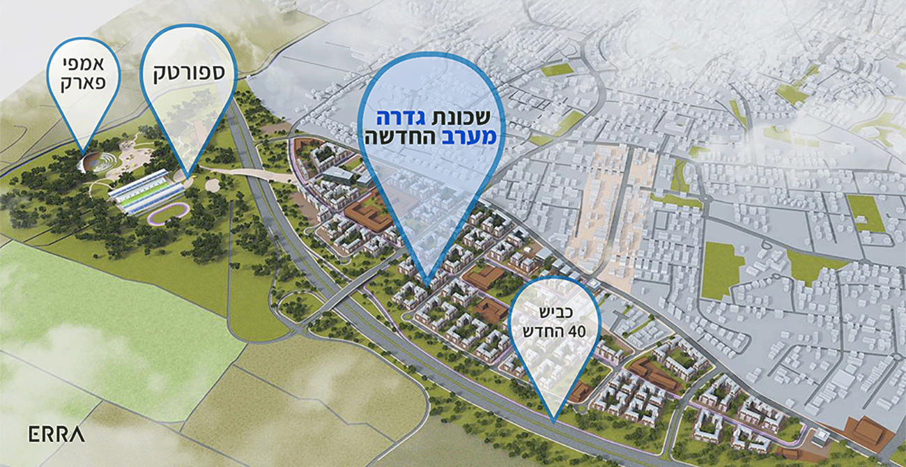
Project 8: West Gedera Residential And Employment District (Complex 8)
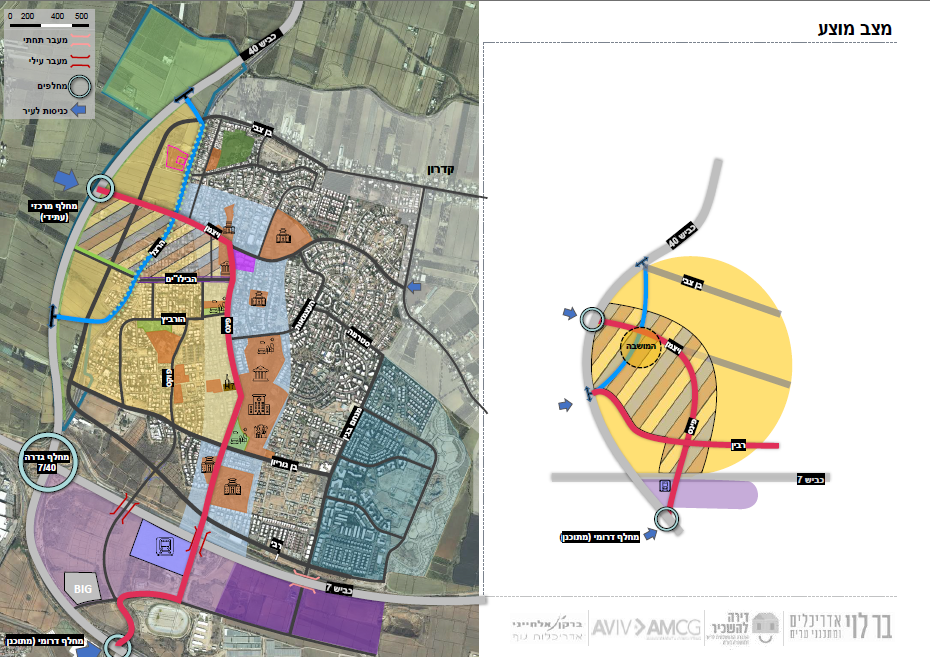
Location and general characteristics: Complex 8 extends to the west of Gedera, between Herzl Street (old Highway 40) in the east and the route of the new Highway 40 planned as a bypass from the west (conversion of Highway 40 into an eastern bypass).
The planning area is huge in relation to the settlement – approximately 1,400 dunams – and constitutes the main development reserve for the expansion of Gedera to the west. Open areas along the Sorek River are intended to remain, as a riverside greenway and ecological corridor without any plans of future construction. Already at the Outline Planning Stage, it was decided to leave a 100-meter-wide green strip on both sides of the stream to be exempt from any construction, and indeed this strip was removed from the development area in the detailed plan – a balance between development needs and preserving local natural values. A new urban district is planned in Complex 8, with a diverse mix of uses: residential neighborhoods, employment and commercial areas, public institutions, as well as parks and recreational areas. According to the planning, residential construction will be relatively saturated (apartment buildings up to 6 floors, without ground-level homes) in order to utilize the area efficiently.
Plan 453-0340554 Gedera
Planning status: A detailed urban development plan (Taba 460-1050020) for Complex 8 is in advanced preparation in collaboration with "Apartment for Rent" and the local council. In February 2024, the complex was declared a "preferred housing complex" in the Hvatmal track (National Committee for Housing in Preferred Complexes) in order to accelerate approval. The detailed plan is expected to contain a significantly larger volume of housing units than the approved outline – at the public participation meeting in October 2022, it was reported that the plan will include ~3,200 housing units, instead of ~1,900–2,000 units set in the outline. This change makes the West Gedera neighborhood one of the largest projects in the area. As of today, the urban planning plan for Complex 8 has not yet been officially submitted but is in the final planning stages for submission to the Ministry of Housing and Urban Development. If the process progresses properly, it is estimated that final approval will be received within a few years (an optimistic estimate of ~4–6 years for approval and compromise).
Planned building rights: According to the comprehensive outline plan, Complex 8 was originally planned to have approximately 2,000 housing units, approximately 45,000 square meters of commercial space, and approximately 25,000 square meters of offices, as well as a recreation center (country club) of about 8,500 square meters. In the updated detailed plan, the numbers have increased to approximately 3,000–3,200 housing units in total, with minor changes to the scope of commerce and employment (subject to final approval). In addition, approximately 300 dunams in the complex will remain as parks and open green spaces along the stream, as noted above.
Marketing Features: Complex 8 represents a great opportunity but also a challenge for investors. It is land for sale in Gedera that has very high improvement potential – yellow agricultural land (designated for urban development) that will become a new residential neighborhood in the future. Residential agricultural land is expected to double in value (and more) after the zoning change, and therefore the value of the land in Complex 8 already reflects this expectation: agricultural land plots there are being sold for around NIS 2,000–2,500 per square meter. The attractiveness of investing in this land is considered very good compared to the alternatives, but it is important to remember that this is a speculative investment with risks. First, private ownership of the land is split between dozens of plot owners, which requires a complex and lengthy consolidation and division process (and indeed, the parcellation process has already begun as part of the plan's promotion). Second, the timetable for final approval and settlement is not guaranteed – even with the fast track of the Land Development and Urban Development Agency, it will be at least several years before it can actually be built. Third, there is a gap between marketing promises and planning reality: private marketers sometimes present rosy predictions (for example, "the land will be ready for settlement within 4 years"), but in practice there may be delays in decisions, public objections, or changes in planning requirements. The bottom line is that an investor who is willing to wait in the medium-long term may enjoy a significant increase in value, but also requires patience and a certain amount of uncertainty. The real estate experts' rating for Complex 8 reflects this: the profit potential is estimated at ~2.0/5, the location at 3/5, and the certainty of settlement at 3/5 – bringing the overall investment rating to approximately 2.7 out of 5.
The land division process: It should be remembered that a purchaser of agricultural land in Complex 8 (and similar complexes) is effectively joining as a passive owner in the land that will undergo reorganization. As part of the consolidation and division process, each plot owner will in the future receive a new plot that is not necessarily in the same location as their original plot, but "as close as possible" to the original location according to the planning team's considerations. This means that if you purchased a particular plot today, you may in the future receive a parallel plot in another area within the complex, according to the new allocation schedule. This information emphasizes the need to carefully review the plan documents – and to set realistic expectations regarding what will be received at the end of the process.
Suggested status
Project 9: Sorek River Complex – Environmental Conservation (Complex 9)
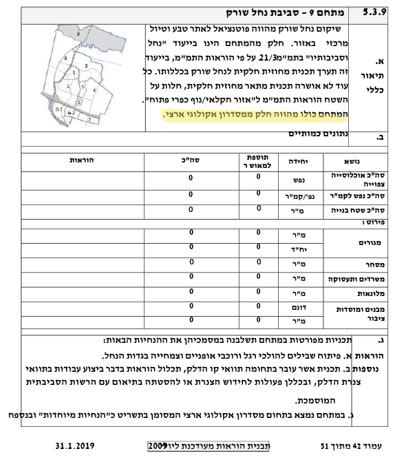
Location and general characteristics: "Project" 9 is in fact a site for environmental conservation, and not a classic real estate project. Complex 9 extends north of Gedera, along the channel of the Sorek River, separating the built-up area of the settlement from the river channel. The plots of the complex are about 500 meters away from the houses of the northern Shapira neighborhood in Gedera. The area of the complex is several hundred dunams (a long narrow strip along the river), with ownership split between dozens of private owners. In effect, the complex consists of several blocks and plots (for example, block 3865 and adjacent plots) that together form a continuous open river space.
Plan 453-0340554 Gedera
Designation and planning: In accordance with TAM 21/3 (the Central District Outline Plan), the land in Area 9 is designated entirely for a stream area and its surroundings – open areas for conservation and agriculture without urban development. The Comprehensive Outline Plan of Gedera (2019) also defined the entire area as a river strip for restoration and conservation, including a designation for a public park along the river. This means that Area 9 has no residential, commercial, or employment designation, and is not granted any building rights for real estate development. The land will remain in an agricultural/landscape designation only. Permitted uses of this land will be agricultural cultivation, crops, or leisure and recreation in the great outdoors – and with a special permit, approval may be granted for small agricultural facilities (such as a warehouse for agricultural tools or a packing house), but this too is limited and subject to strict requirements. It is important to emphasize: There is no intention to change the land use designation in Complex 9, neither in the near term nor in the foreseeable future. No detailed plan is being proposed for the complex, and its status will remain "green agricultural land" designated for conservation. Any private initiative to try and build there is doomed to be rejected out of hand, unless there is a dramatic policy change at the provincial or national level – a change that is considered unlikely in the coming years.
Marketing Features: For potential investors, Complex 9 is a prime example of land that is not intended for development. This is not land for real estate investment at all, but rather a "green lung" for conservation for the benefit of the public. This land does not have a planned settlement process – it is not "yellow land" but completely green land. Despite this, quite a few private parties have tried and are trying to market plots in Complex 9 with vague promises like "land by the stream that will be settled in a few years." It is important to understand: the chances of this land being settled are extremely slim, both in the near term and in the distant future. In fact, in 2017, government regulations were even amended that were intended to combat this fraudulent phenomenon – the sale of "green" agricultural land without a planning horizon under the false pretense of imminent settlement. Professional bodies, led by the Planning Administration and the Central District, mark the area as a strip of stream for conservation for generations, and recommend that the public not invest in it. Objective real estate experts clarify that the entire complex will remain agricultural for a very long time, and investing in it may be considered as a risky bet. Accordingly, land prices also reflect agricultural value only: plots in Complex 9 are traded at very low prices – estimated at only ~130–150 NIS per square meter – compared to thousands of shekels per square meter in the yellow lands (Complexes 7 and 8). For most investors, the land in Nahal Sorek is nothing more than a beautiful open space for a nature walk, but not an asset that will lead to financial profit.
Summary And Conclusion
Gedera presents a unique combination of land reserves on the outskirts of the settlement – some of them are intended to become new residential neighborhoods and employment complexes that will contribute to the growth of the settlement, and some are intended to remain as a green and protected backdrop for future generations. Project 7 and Project 8 illustrate the potential inherent in the release of agricultural land: these lands are no longer "just fields" but are anchored in urban planning, which outlines the future neighborhood of Gedera on paper. Investing in them can be worthwhile, but requires an understanding of the process, patience and trust that the plans will actually mature into implementation. "Project" 9, on the other hand, illustrates the other side of the coin – not every plot of land is destined to become a tower or a shopping mall; there are lands whose true value lies in their preservation as open space for the benefit of nature and the community. For the investor, this knowledge is critical: there are lands (like Area 9) that are intended for nature and landscape only, and will not yield financial profit.
Summary And Conclusion
Before deciding to invest in agricultural land, it is very important to conduct due diligence and act with discretion. It is recommended to use the tools offered by official bodies: for example, to review the Planning Administration website (to check the land designation in the planning information system), the RAMI website (regarding state lands), and the GIS systems of the Gedera local committee. It is worth searching Google for the relevant plan numbers, reading the minutes of the planning committee discussions (they are public and available for download), and keeping up to date with local and district council decisions. Investing in land for improvement can be very profitable, but only when it is done in the right places and with realistic expectations. In the case of Gedera, as we have seen, there are promising opportunities – alongside "mines" that must be guarded against. With proper analysis of the information and accompanied by professional advice (for example, a real estate appraiser specializing in agricultural lands), the investment can be steered to safe and fertile land. Good luck!
Need us to make an appointment for you? Talk with us!
The Israeli Real Estate market is in continuous momentum and prices continue to rise from moment-to-moment. Let us match you with the right investment for you.
Thank you! Our specialist will contact you within 1 hour or the next day.
Working hours: 10:00 - 19:00 Non-working days: Friday, Saturday
Oops! Something went wrong while submitting the form.


.png)